Machias Valley Airport (FAA Identifier=MVM)
Located at:
52 Airport Road
Machias, ME 04654
Mailing Address:
P.O. Box 418
Machias, ME 04654
Phone: 207-255-6621
Machias Valley Airport (facebook) – click here for
Airport monthly Tie Down Form
Airport short-term Tie Down Form
Airport Weather Cam – click here
MACHIAS VALLEY AIRPORT FY 24-25-26
PUBLIC NOTICE
The Town of Machias hereby announces its proposed Disadvantaged Business Enterprise (DBE) participation goal of 3.9% for Federal Aviation Administration funded contracts/agreements. The proposed goal pertains to federal fiscal years October 1, 2024 through September 30, 2026.
Comments on the DBE goal will be accepted 30 days from the date of this publication and can be sent to the following:
Sarah Dedmon
Town of Machias
Interim Operations Manager
P.O. Box 418
17 Stackpole Road
Machias, Maine 04654
operationsmanager@machiasme.org
or
Kimberly Robinson-Harris
Federal Aviation Administration
Office of Civil Rights
800 Independence Avenue SW
Washington, DC 20591
(202) 267-8747
Kimberly.L.Robinson.Harris@faa.gov
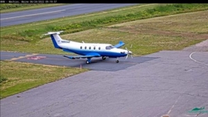
Maine Instrument Flight Training – now offered in Machias
Fuel is now available at the Machias Valley Airport
Machias Valley Airport’s broadband internet is donated by Wireless Partners LLC, and Trailrunner Wireless.

BUILDING FOR THE FUTURE (MVM) –
Mission Statement/Improvements and Request for Assistance
Click here for more info
Donations given by Machias Savings Bank – $50,000.00 and Bold Coast Smoke Shop – $12,500.00 – click here for picture
Johnson’s Town Line – Rent a car (East Machias)
click here for more information
Turo Rent a Car
click here for more information
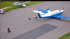
Charter Flights –
Penobscot Island Air – Click here for more info.
Owls Head, Maine
207-596-7500
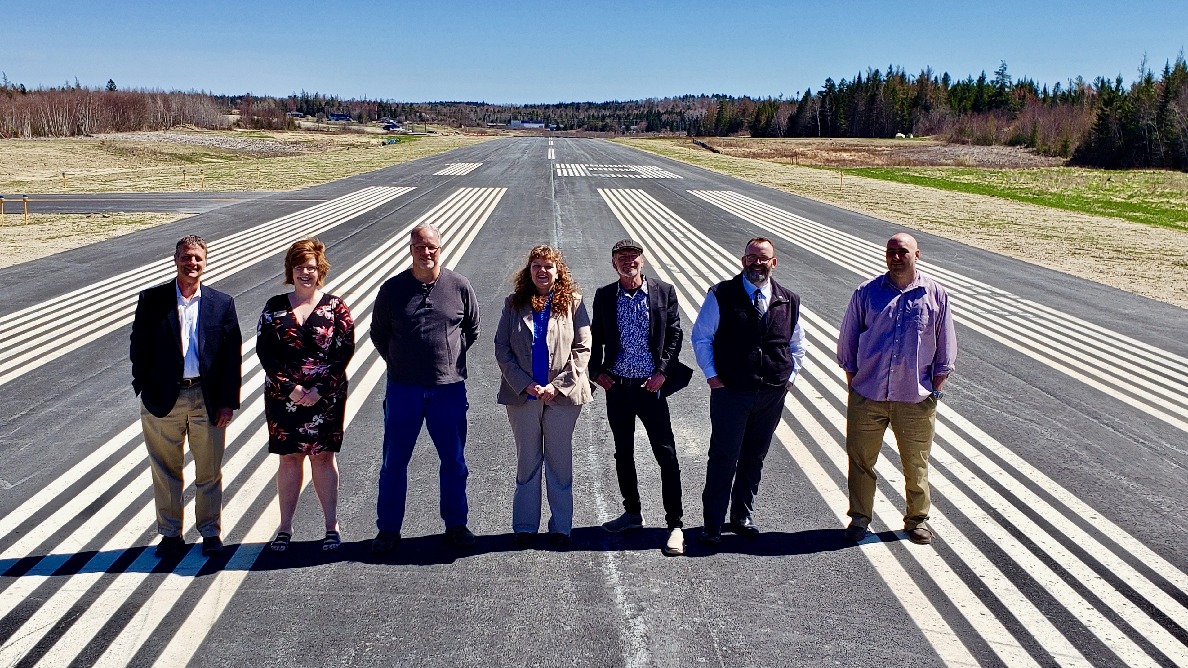
KMVM Machias Airport Committee Annual Report
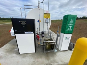
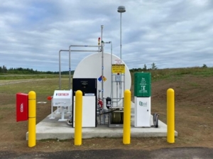
The past year has seen the completion of the fuel farm at the airport. We are actively
promoting the airport and fuel sales. To date we have sold approximately 1000 gallons of 100LL aviation fuel. That would be a gross income from sales of $6,890.00 at our current price. We unfortunately, due to tank delivery delays, purchased the fuel at its height in price. We will see a decrease in price at our next purchase. This fuel is not only available for aircraft use, but can also be purchased for use in off-road vehicles and equipment.
The design and engineering for the taxiway and hangar area is well underway. The anticipated timing for the bid process and project start date will be spring FY24. We have individuals who have tentatively made the commitment to leasing a lot for hangar construction to begin within one year of the completion of the taxiway. This is an income generating improvement.
We have contracted with our engineering firm to begin the process for the construction of the new longer runway. The initial phase will be environmental assessment and property
acquisition. The new longer runway with instrument landing systems will improve access by larger aircraft and allowing aircraft to land in less than favorable weather conditions. LifeFlight of Maine is fully behind the construction of the new runway. This past year, 168 requests for LifeFlight fixed wing services could not be accommodate due to weather and runway length. What would have been a 10-15 minute flight turned into an hour or more by helicopter.
Machias Aviation Services, Inc., a non-profit created to support the airport was able to host pancake breakfasts throughout the summer as weather permitted. They will continue that tradition this year. “All You Can Eat” Pancake breakfasts are scheduled for the 3rd Saturday for the months of June, July, and August from 7-9am. All are welcome!
As we continue to promote and improve the airport, we look forward to continued support and partnership from and with the local community.
Michael Radeka
Airport Committee Chair
Mission Statement
The Machias Valley Airport’s mission is to safely and efficiently provide aerial access to the Town of Machias and Washington County, Maine, as well as provide access to the national air transportation network. The Airport is operated and maintained in a professional, responsible, and businesslike manner while serving the transportation interests of all the citizens of Machias and Washington County. The airport also promotes commercial, economic, and industrial development in the Town. The Town of Machias will plan, develop, operate, and maintain airport facilities that meet or exceed federal and state standards.
Find us on Facebook: https://www.facebook.com/pages/Machias-Valley-Airport/141209545905268
General Information
 The Machias Valley Airport is owned and operated by the Town, and it is a public use facility (i.e. does not require prior permission to takeoff or land there). The Town Manager is the airport manager. There is no fixed operator at the airport and no commercial tenants. There is an active airport group, anchored by the local squadron of the Civil Air Patrol.
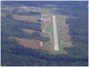
The Airport is situated on 30+/- acres in the Town of Machias, ME at an elevation of 96 feet above mean sea-level. It has one runway designed 18/36 with an asphalt surface measuring 2,909 by 60 feet. The Machias facility has no tower and a short, 2,900 foot runway that can only accommodate single-engine aircraft. Helicopters operate at MVM although there is no designated helipad at the airport, nor specific approach-departure routes for helicopters.
 Machias Valley Airport has a Unicom advisory radio frequency (122.8 MHz) that allows pilots to self-announce their position and intentions, and also to turn on the runway lights.
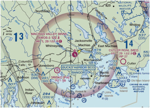
http://www.airnav.com/airport/KMVM
Machias Valley Airport (MVM) is classified by the FAA and Maine DOT as a general aviation airport and does not have any scheduled airline service.
Runway Improvements
New runway project was completed in the fall of 2018.
Natural Resource Survey
Completed in January 2012
The survey was conducted on the approximately 70 acre property. The purpose of the natural resources survey was to identify wetlands, streams, and wildlife habitat.
The Machias Valley Airport is located south of the Machias River. The airport is bordered by U.S. Route 1 and associated residential properties to the south and the Machias River to the North. The land around the runway is undeveloped with areas of blueberry barren, mature forest, and abandoned pastureland. The southern portion of the property drains southwesterly into a small network of streams. The northern portion of the property slopes towards the river. Soil onsite vary considerably, consisting of areas of deep organic matter over marine parent material to loamy till parent materials. Silt loam and fine sandy loam textured soils are common throughout the site as well.
The survey identified 12 jurisdictional wetlands totaling approximately 11 acres. The vernal pool survey identified 3 vernal pools. None of the pools appear to be jurisdictional at the state level.
Run way Information
| Dimensions: | 2879 x 60 ft. / 877 x 18 m | ||
| Surface: | asphalt, in excellent condition | ||
| Weight bearing capacity: | Single wheel: 12.5 | ||
| Runway edge lights: | medium intensity | ||
| Runway edge markings: | New | ||
| RUNWAY 18 | RUNWAY 36 | ||
| Latitude: | 44-42.40383N | 44-41.96763N | |
| Longitude: | 067-28.84536W | 067-28.58548W | |
| Elevation: | 96.3 ft. | 70.3 ft. | |
| Gradient: | 0.9% DOWN | 0.9% UP | |
| Traffic pattern: | left | left | |
| Runway heading: | 176 magnetic, 157 true | 356 magnetic, 337 true | |
| Markings: | nonprecision, in fair condition | nonprecision, in fair condition | |
| Runway end identifier lights: | no | yes | |
| Touchdown point: | yes, no lights | yes, no lights | |